Heading for the Scottish Hills
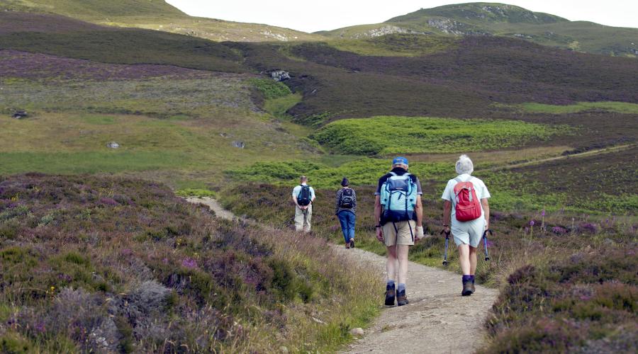
Use this service all year to plan hill routes that avoid disturbing deer stalking.
Heading for the Scottish Hills
The Heading for the Scottish Hills service helps you find out where deer stalking is taking place on Munros, Corbetts and other popular hills throughout Scotland, so you can plan hill routes that minimise the chance of disturbing stalking, in line with the Scottish Outdoor Access Code.
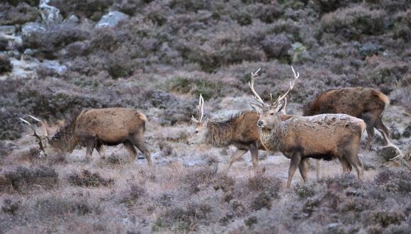
Managing the number of deer and their environmental impact is vital if we are to effectively tackle the nature loss and climate crisis facing Scotland. From 2023, male deer stalking can take place all year round, so the Heading for the Scottish Hills service has also expanded to provide stalking information all year. You can help by minimising disturbance to stalking, especially during key busier periods in the autumn (particularly the first 3 weeks of October) and winter (late January to mid-February). Please use this website or other information sources to help plan your routes all year.
By taking simple steps to avoid deer disturbance, such as finding out where deer stalking is taking place and following a route which avoids it, being flexible and following reasonable requests to use alternative routes and paying close attention to signage, you can play an important role in the recovery of our uplands, fighting climate change, increasing biodiversity and helping rural businesses and communities.
Also remember to always keep your dog in sight and under control when exploring the Scottish hills - if in doubt use a lead.
The map and tables linked below provide stalking information for popular hills throughout Scotland. Hind stalking information will continue to be added during the 2023/2024 Winter.
Even if you head to the hills often, you should check this page regularly to get up-to-date information to help you plan your route.
Some estates provide broad messages indicating the general period when deer stalking takes place. If required use the contact details provided to get further information to help you plan your route.
If specific information for your route is not available, you can minimise the risk of disturbance by:
- Paying close attention to signage on arrival and throughout your visit and following reasonable advice from land managers on alternative routes.
- Using paths and follow ridges.
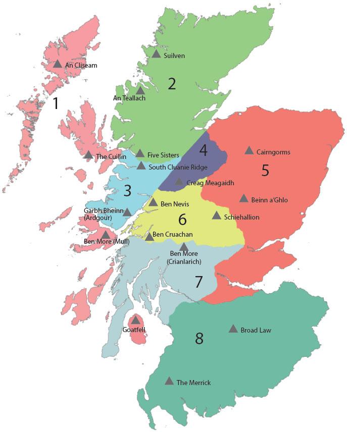
1. Islands
2. Northern Highlands
North of Glen Shiel and the Great Glen.
3. Western Highlands
West of the Great Glen and south of Glen Shiel.
4. Creag Meagaidh and The Monadhliath
5. Eastern Highlands
East of the A9 (Perth-Inverness).
6. Central Highlands
Area enclosed by Loch Linnhe, Glen Spean, the A9 (Inverness-Perth) and the A85 (Perth-Lochearnhead-Crianlarich-Oban). Includes Glen Coe, Glen Nevis, Ben Lawers, Ben Alder and the Drumochter Hills (west).
7. Southern Highlands
South of the A85 (Perth-Lochearnhead-Crianlarich-Oban).
Find out more
How to join Heading for the Scottish Hills – information for land managers
Deer stalking and public access – Guidance on stalking communication
Last updated: